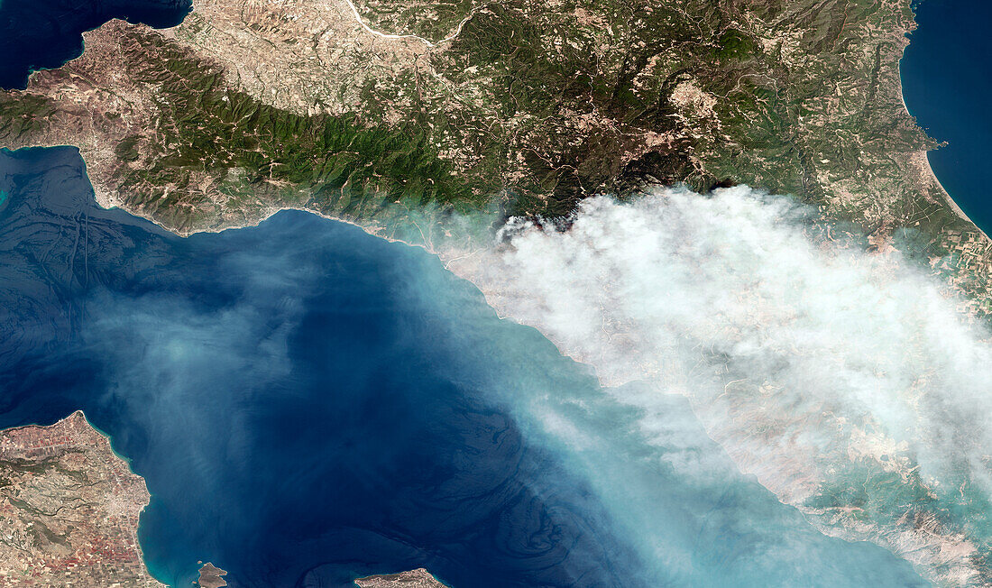
Forest fires on Euboea, Greece, satellite image
Bildnummer 14241068

| Satellite image of forest fires Euboea, Greece. In 2021, about 1250 square kilometres of forest and farmland were burned during the worst fire season since 2007. Over 5000 hectares were burned in northern Euboea alone. The World Meteorological Organization are linked the fires to the extreme weather being caused by climate change. Image obtained by the SPOT satellite on 5 august 2021. | |
| Lizenzart: | Lizenzpflichtig |
| Credit: | Science Photo Library / AIRBUS DEFENCE AND SPACE |
| Bildgröße: | 5965 px × 3537 px |
| Modell-Rechte: | nicht erforderlich |
| Eigentums-Rechte: | nicht erforderlich |
| Restrictions: | - |
Preise für dieses Bild ab 15 €
Universitäten & Organisationen
(Informationsmaterial Digital, Informationsmaterial Print, Lehrmaterial Digital etc.)
ab 15 €
Redaktionell
(Bücher, Bücher: Sach- und Fachliteratur, Digitale Medien (redaktionell) etc.)
ab 30 €
Werbung
(Anzeigen, Aussenwerbung, Digitale Medien, Fernsehwerbung, Karten, Werbemittel, Zeitschriften etc.)
ab 55 €
Handelsprodukte
(bedruckte Textilie, Kalender, Postkarte, Grußkarte, Verpackung etc.)
ab 75 €
Pauschalpreise
Rechtepakete für die unbeschränkte Bildnutzung in Print oder Online
ab 495 €
Keywords
- 2000er Jahre,
- 21. Jahrhundert,
- Ackerland,
- atmosphärisch,
- August,
- blasend,
- Erdbeobachtung,
- Europa,
- europäisch,
- extrem,
- Feuer,
- geografisch,
- Geographie,
- Globale Erwärmung,
- Griechenland,
- Griechisch,
- Hitzewelle,
- Katastrophe,
- Klimawandel,
- Land,
- Meer,
- Meteorologie,
- meteorologisch,
- Mittelmeer,
- Natur,
- Naturkatastrophe,
- Ozean,
- Rauch,
- saisonal,
- Satellit,
- Satellitenbild,
- Schaden,
- Sommer,
- Stelle,
- tödlich,
- Umwelt,
- Verbrennung,
- Wald,
- Waldbrände,
- Wasser,
- Weltall,
- Wetter,
- wild,
- Zerstörung
