Sentinel-6 Michael Freilich satellite undergoing testing
Bildnummer 13673552
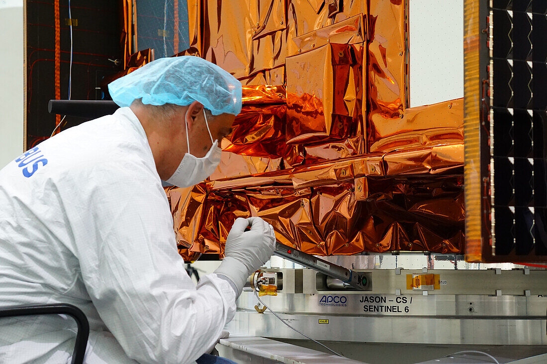
| Copernicus Sentinel-6 Michael Freilich satellite undergoing testing at the cleanroom of IABG, Ottobrunn, Germany. The Sentinel 6 program consists of 2 identical satellites that will measure sea surface levels and sea ice thickness. Each satellite carries a radar altimeter to provide high-precision and timely observations of the topography of the global ocean in an effort to better understand and monitor climate change. The first Sentinel 6 satellite was launched in 2020. The second Sentinel 6 satellite is scheduled for launch in 2026. | |
| Lizenzart: | Lizenzpflichtig |
| Credit: | Science Photo Library / AIRBUS DEFENCE AND SPACE |
| Bildgröße: | 6000 px × 4000 px |
| Modell-Rechte: | Derzeit liegt noch kein Release vor. Bitte kontaktieren Sie uns vor Verwendung. |
| Eigentums-Rechte: | nicht erforderlich |
| Restrictions: |
|
Preise für dieses Bild ab 15 €
Universitäten & Organisationen
(Informationsmaterial Digital, Informationsmaterial Print, Lehrmaterial Digital etc.)
ab 15 €
Redaktionell
(Bücher, Bücher: Sach- und Fachliteratur, Digitale Medien (redaktionell) etc.)
ab 30 €
Werbung
(Anzeigen, Aussenwerbung, Digitale Medien, Fernsehwerbung, Karten, Werbemittel, Zeitschriften etc.)
ab 55 €
Handelsprodukte
(bedruckte Textilie, Kalender, Postkarte, Grußkarte, Verpackung etc.)
ab 75 €
Pauschalpreise
Rechtepakete für die unbeschränkte Bildnutzung in Print oder Online
ab 495 €
Keywords
- 21. Jahrhundert,
- Ausrüstung,
- copernicus,
- Deutsche,
- Deutschland,
- eine Person,
- esa,
- Europa,
- europäisch,
- Europäische Weltraumbehörde,
- Forschung,
- geografisch,
- Geographie,
- Gerät,
- Globale Erwärmung,
- IABG,
- Ingenieur,
- Ingenieurwesen,
- Klimatologie,
- klimatologisch,
- Klimawandel,
- Luftfahrt,
- Mann,
- Männlich,
- Maschine,
- Meereskunde,
- Niemand,
- Raumfahrzeug,
- Raumschiff,
- Satellit,
- Technologie,
- technologisch,
- Testen,
- topografisch,
- Topographie,
- topographisch,
- Überwachung,
- Umwelt,
- Umweltwissenschaften,
- vorbereitend,
- Vorbereitung,
- Wetter