Global temperatures
Bildnummer 13673249
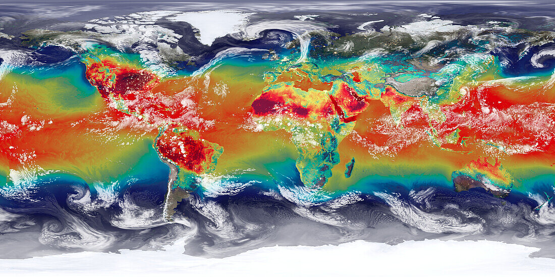
| Map showing surface temperatures are coloured, ranging from 270 to 310 Kelvin. The hottest areas are the deserts of North Africa and the Middle East (centre). Outgoing long-wave radiation at the top of the atmosphere (white) represents clouds in the model. Data based on NASA observations. | |
| Lizenzart: | Lizenzpflichtig |
| Credit: | Science Photo Library / Animate4.com |
| Bildgröße: | 5920 px × 2960 px |
| Modell-Rechte: | nicht erforderlich |
| Eigentums-Rechte: | nicht erforderlich |
| Restrictions: | - |
Preise für dieses Bild ab 15 €
Universitäten & Organisationen
(Informationsmaterial Digital, Informationsmaterial Print, Lehrmaterial Digital etc.)
ab 15 €
Redaktionell
(Bücher, Bücher: Sach- und Fachliteratur, Digitale Medien (redaktionell) etc.)
ab 30 €
Werbung
(Anzeigen, Aussenwerbung, Digitale Medien, Fernsehwerbung, Karten, Werbemittel, Zeitschriften etc.)
ab 55 €
Handelsprodukte
(bedruckte Textilie, Kalender, Postkarte, Grußkarte, Verpackung etc.)
ab 75 €
Pauschalpreise
Rechtepakete für die unbeschränkte Bildnutzung in Print oder Online
ab 495 €
Keywords
- 21. Jahrhundert,
- Atmosphäre,
- atmosphärisch,
- cgi,
- Computermodell,
- Erdbeobachtung,
- Erde,
- Erdkunde,
- farbcodiert,
- geografisch,
- Geographie,
- Hitze,
- Illustration,
- Karte,
- Kunstwerk,
- Land,
- langwellige Strahlung,
- Meer,
- Meteorologie,
- meteorologisch,
- Naturlauf,
- Niemand,
- Oberfläche,
- Ozean,
- Planet,
- planetarisch,
- Projektion,
- Simulation,
- simuliert,
- Strahlung,
- Temperatur,
- Tropen,
- Tropisch,
- Umwelt,
- Welt,
- weltweit,
- Wetter,
- Wolke,
- Wolken