Barringer Crater, LiDAR image
Bildnummer 12950692
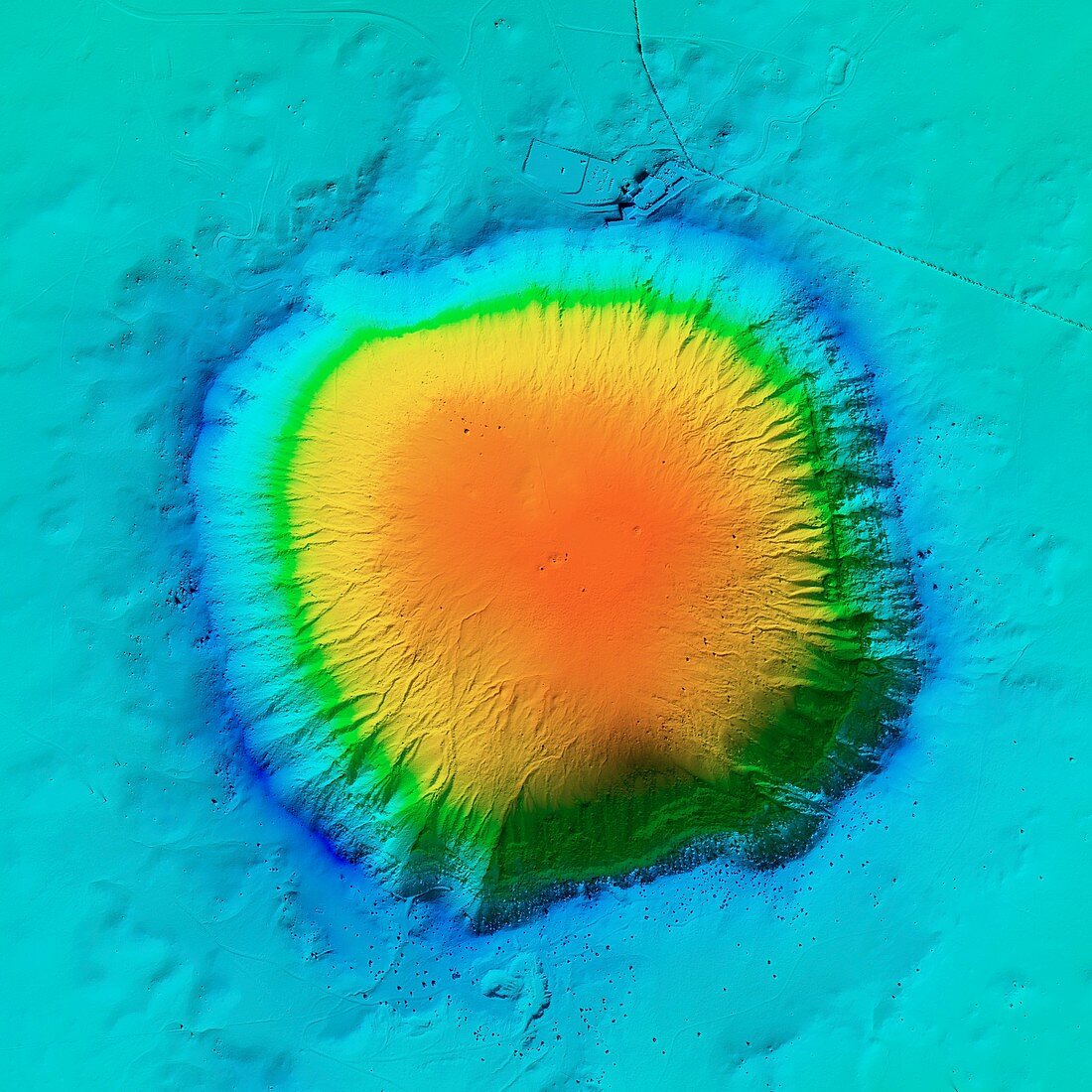
| Barringer Crater, LiDAR image. This crater, also known as Meteor Crater, is located in Arizona, USA. It was formed over 50, 000 years ago by the impact of an iron meteorite (space rock) colliding with the Earth. The meteorite is thought to have weighed more than 10, 000 tonnes. The resulting crater is 183 metres deep, with a diameter of 1200 metres. It is named after the US mining engineer and businessman Daniel Barringer (1860-1929) who first proposed the meteorite impact theory. The site was designated a National Natural Landmark in 1967. LiDAR combines optical and laser imaging to produce digital elevation maps (DEMs), with differences in elevation shown by the colour-coding of the image. Image data obtained by the National Center for Airborne Laser Mapping (NCALM) in the USA. | |
| Lizenzart: | Lizenzpflichtig |
| Credit: | Science Photo Library / NCALM / MATTHEW HURST |
| Bildgröße: | 4180 px × 4180 px |
| Modell-Rechte: | nicht erforderlich |
| Eigentums-Rechte: | nicht erforderlich |
| Restrictions: | - |
Preise für dieses Bild ab 15 €
Universitäten & Organisationen
(Informationsmaterial Digital, Informationsmaterial Print, Lehrmaterial Digital etc.)
ab 15 €
Redaktionell
(Bücher, Bücher: Sach- und Fachliteratur, Digitale Medien (redaktionell) etc.)
ab 30 €
Werbung
(Anzeigen, Aussenwerbung, Digitale Medien, Fernsehwerbung, Karten, Werbemittel, Zeitschriften etc.)
ab 55 €
Handelsprodukte
(bedruckte Textilie, Kalender, Postkarte, Grußkarte, Verpackung etc.)
ab 75 €
Pauschalpreise
Rechtepakete für die unbeschränkte Bildnutzung in Print oder Online
ab 495 €