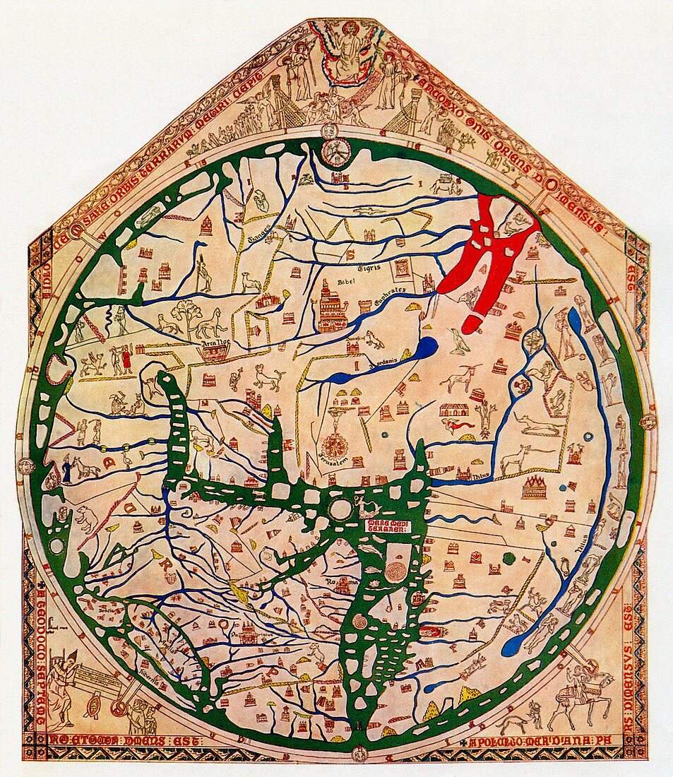
Hereford Mappa Mundi
Bildnummer 12447301

| 19th-century simplified reproduction of the original Mappa Mundi preserved in Hereford Cathedral in England for over 700 years. Drawn about 1290-95 by a church prebendary, Richard de Bello, named on the map as Richard of Haldingham and Lafford. The original, on display in the cathedral, contains over 500 drawings. These include around 420 cities and towns, biblical and mythological scenes, images of people of the world, animals and birds. The design is a classic “T-O†map with Jerusalem at the centre, and the tripartite arrangement of the continents with Asia at the top, Europe bottom left and Africa bottom right. It is probable that this map was copied from an older map that itself was descended from a map of the Roman Empire such as the Orbis Terrarum of Agrippa. This map records how the spiritual and geographic aspects of the world were interpreted by 13th-century scholars. | |
| Lizenzart: | Lizenzpflichtig |
| Credit: | Science Photo Library / Terry, Sheila |
| Bildgröße: | 4115 px × 4751 px |
| Modell-Rechte: | nicht erforderlich |
| Eigentums-Rechte: | nicht erforderlich |
| Restrictions: | - |
Preise für dieses Bild ab 15 €
Universitäten & Organisationen
(Informationsmaterial Digital, Informationsmaterial Print, Lehrmaterial Digital etc.)
ab 15 €
Redaktionell
(Bücher, Bücher: Sach- und Fachliteratur, Digitale Medien (redaktionell) etc.)
ab 30 €
Werbung
(Anzeigen, Aussenwerbung, Digitale Medien, Fernsehwerbung, Karten, Werbemittel, Zeitschriften etc.)
ab 55 €
Handelsprodukte
(bedruckte Textilie, Kalender, Postkarte, Grußkarte, Verpackung etc.)
ab 75 €
Pauschalpreise
Rechtepakete für die unbeschränkte Bildnutzung in Print oder Online
ab 495 €
