ERS-1 image of fields in reclaimed Polder,Holland
Bildnummer 11748429
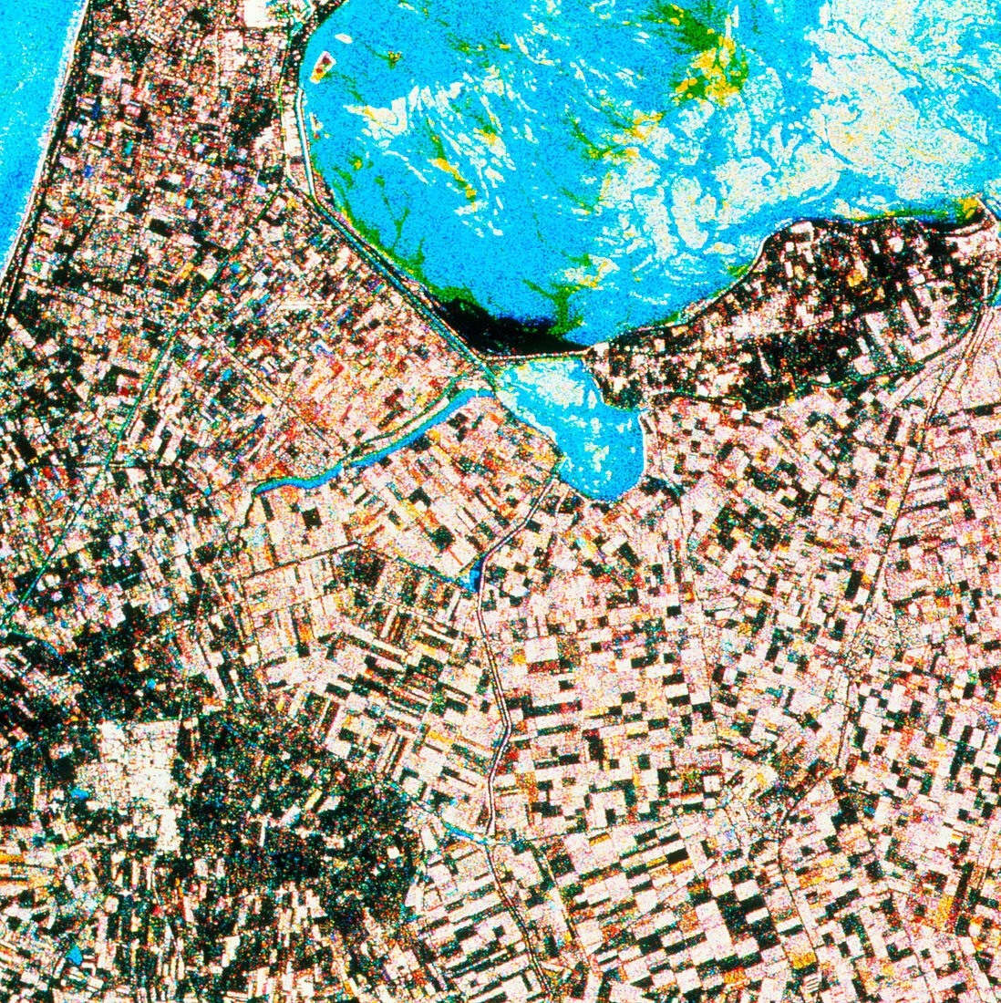
| Agriculture. ERS-1 multitemporal radar image of field patterns in Wieringermeer Polder,the Netherlands. This image was made by combining three images made over a period of six days. The radar view shows the patterns of fields in this reclaimed land (right half of frame) to good effect. The different tones of the fields reflect the moisture of the soil (darkest) and vegetation (pale). The bright area toward lower left is the town of Schagen. The various colours in the water at upper right are a result of changes of the state of the surface between frames. The data for this image were gathered by the ERS-1 European radar mapping satellite | |
| Lizenzart: | Lizenzpflichtig |
| Credit: | Science Photo Library / ESA, EURIMAGE |
| Bildgröße: | 3263 px × 3270 px |
| Modell-Rechte: | nicht erforderlich |
| Eigentums-Rechte: | nicht erforderlich |
| Restrictions: |
|
Preise für dieses Bild ab 15 €
Universitäten & Organisationen
(Informationsmaterial Digital, Informationsmaterial Print, Lehrmaterial Digital etc.)
ab 15 €
Redaktionell
(Bücher, Bücher: Sach- und Fachliteratur, Digitale Medien (redaktionell) etc.)
ab 30 €
Werbung
(Anzeigen, Aussenwerbung, Digitale Medien, Fernsehwerbung, Karten, Werbemittel, Zeitschriften etc.)
ab 55 €
Handelsprodukte
(bedruckte Textilie, Kalender, Postkarte, Grußkarte, Verpackung etc.)
ab 75 €
Pauschalpreise
Rechtepakete für die unbeschränkte Bildnutzung in Print oder Online
ab 495 €