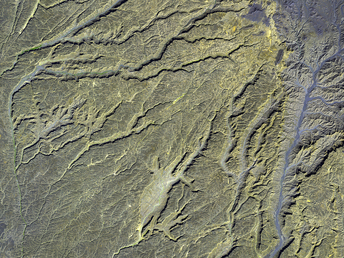
Tibesti volcanic canyons,satellite image
Bildnummer 11744824

| Tibesti volcanic canyons,satellite image. North is at the top. These canyons are found on the southwest side of an extinct volcano in the Tibesti volcanic range,which spans northwest Chad and southern Libya in the Sahara Desert of North Africa. The canyons are widest at the upper areas of the slopes (upper right) and narrow as they go down. The blue areas of the canyons do not represent water but volcanic rock that formed from cooling lava. The large blue area (top right) is a caldera,land formed from a crater that collapsed after violently erupting. Image taken on 12th January 2003 by ASTER (Advanced Spaceborne Thermal Emission and Reflection Radiometer) on NASA's Terra satellite | |
| Lizenzart: | Lizenzpflichtig |
| Credit: | Science Photo Library / ASTER SCIENCE TEAM / GSFC / NASA |
| Bildgröße: | 3600 px × 2700 px |
| Modell-Rechte: | nicht erforderlich |
| Eigentums-Rechte: | nicht erforderlich |
| Restrictions: | - |
Preise für dieses Bild ab 15 €
Universitäten & Organisationen
(Informationsmaterial Digital, Informationsmaterial Print, Lehrmaterial Digital etc.)
ab 15 €
Redaktionell
(Bücher, Bücher: Sach- und Fachliteratur, Digitale Medien (redaktionell) etc.)
ab 30 €
Werbung
(Anzeigen, Aussenwerbung, Digitale Medien, Fernsehwerbung, Karten, Werbemittel, Zeitschriften etc.)
ab 55 €
Handelsprodukte
(bedruckte Textilie, Kalender, Postkarte, Grußkarte, Verpackung etc.)
ab 75 €
Pauschalpreise
Rechtepakete für die unbeschränkte Bildnutzung in Print oder Online
ab 495 €
Keywords
- 21. Jahrhundert,
- Afrika,
- Afrikanisch,
- Aster,
- Berg,
- Berge,
- Betrachtung,
- Caldera,
- geografisch,
- Geographie,
- infrarot,
- ir,
- Krater,
- Lava,
- NASA,
- Reichweite,
- Satellit,
- Satellitenbild,
- Schlucht,
- Schluchten,
- Tal,
- Täler,
- Terra,
- Umwelt,
- Vulkan,
- vulkanisch,
- Vulkanologie,
- Weltall
