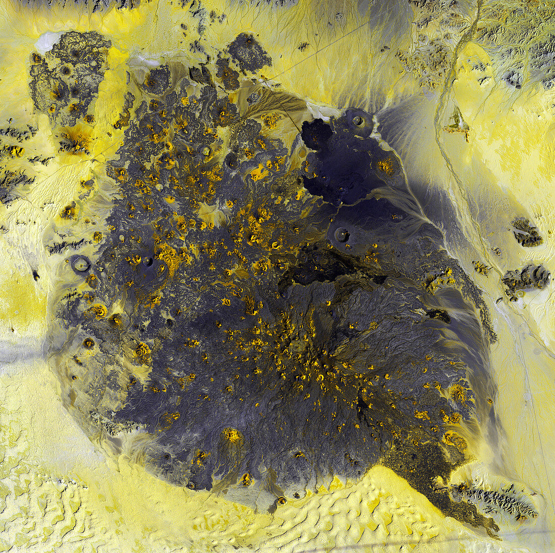
Volcanic landscape,satellite image
Bildnummer 11740790

| Volcanic landscape,satellite image. North is at upper left. Desert sands are yellow,and volcanic rock is dark grey. The patches of yellow on the volcanic rock are summits of volcanic cones that are part of this lava field. The area is Pinacate National Park in Mexico's Sonora Province,close to the Pacific coast. Among hundreds of volcanic vents and cinder cones are rare maar craters,formed when rising magma met underground water to create pockets of steam that blew nearly circular holes in the overlying crust. Sand dunes are across bottom,and a dry river bed is at upper right. The area shown in this image is around 60 kilometres wide. The image data was obtained on 5 December 2002,by the Landsat 7 satellite | |
| Lizenzart: | Lizenzpflichtig |
| Credit: | Science Photo Library / NASA |
| Bildgröße: | 4800 px × 4789 px |
| Modell-Rechte: | nicht erforderlich |
| Eigentums-Rechte: | nicht erforderlich |
| Restrictions: | - |
Preise für dieses Bild ab 15 €
Universitäten & Organisationen
(Informationsmaterial Digital, Informationsmaterial Print, Lehrmaterial Digital etc.)
ab 15 €
Redaktionell
(Bücher, Bücher: Sach- und Fachliteratur, Digitale Medien (redaktionell) etc.)
ab 30 €
Werbung
(Anzeigen, Aussenwerbung, Digitale Medien, Fernsehwerbung, Karten, Werbemittel, Zeitschriften etc.)
ab 55 €
Handelsprodukte
(bedruckte Textilie, Kalender, Postkarte, Grußkarte, Verpackung etc.)
ab 75 €
Pauschalpreise
Rechtepakete für die unbeschränkte Bildnutzung in Print oder Online
ab 495 €
Keywords
- 2000er Jahre,
- 21. Jahrhundert,
- Dezember,
- Erdbeobachtung,
- Erdkunde,
- Felsig,
- geografisch,
- Geographie,
- Geologie,
- geologisch,
- heiß,
- Kegel,
- Land,
- Landsat 7,
- Mexikaner,
- Mexiko,
- Natur,
- Nordamerika,
- nordamerikanisch,
- sandig,
- Satellit,
- Satellitenbild,
- sonora,
- trocken,
- Umwelt,
- Vulkangestein,
- vulkanisch,
- Vulkanologie,
- Weltall,
- Wüste,
- Zapfen
