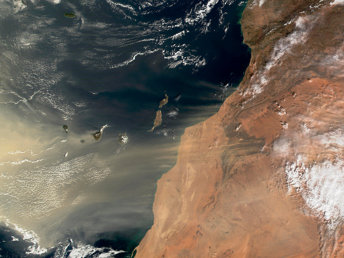
Sand storm over Canary Islands
Bildnummer 11737770

| Sand storm. True-colour satellite image of a sand storm from the Sahara Desert,Africa (right),over the Canary Islands (centre left) in the Atlantic Ocean. North is at top. Arid areas are brown,water is blue and clouds are white. Plumes of wind-borne dust and sand can be seen extending westwards from the African coast over the Canary Islands. This was the worst sand storm ever recorded there. Image taken on 6 January 2002 by the Moderate Resolution Imaging Spectroradiometer (MODIS) aboard NASA's Terra satellite | |
| Lizenzart: | Lizenzpflichtig |
| Credit: | Science Photo Library / NASA |
| Bildgröße: | 3500 px × 2625 px |
| Modell-Rechte: | nicht erforderlich |
| Eigentums-Rechte: | nicht erforderlich |
| Restrictions: | - |
Preise für dieses Bild ab 15 €
Universitäten & Organisationen
(Informationsmaterial Digital, Informationsmaterial Print, Lehrmaterial Digital etc.)
ab 15 €
Redaktionell
(Bücher, Bücher: Sach- und Fachliteratur, Digitale Medien (redaktionell) etc.)
ab 30 €
Werbung
(Anzeigen, Aussenwerbung, Digitale Medien, Fernsehwerbung, Karten, Werbemittel, Zeitschriften etc.)
ab 55 €
Handelsprodukte
(bedruckte Textilie, Kalender, Postkarte, Grußkarte, Verpackung etc.)
ab 75 €
Pauschalpreise
Rechtepakete für die unbeschränkte Bildnutzung in Print oder Online
ab 495 €
Keywords
- Afrika,
- Afrikanisch,
- Atlantischer Ozean,
- Atmosphäre,
- atmosphärisch,
- Bilderwelt,
- Insel,
- Kanarische Inseln,
- Klima,
- Küste,
- Küsten,
- Küsten-,
- Land,
- Meer,
- Meteorologie,
- modis,
- Ozeane,
- Satellitenbild,
- Spektrometer,
- Spektroradiometer,
- Staub,
- Staubig,
- Stürme,
- Terra,
- trocken,
- Wasser,
- Weltall,
- Wetter,
- Wind,
- Windig,
- Wolke,
- Wolken,
- Wolkig,
- Wüste
