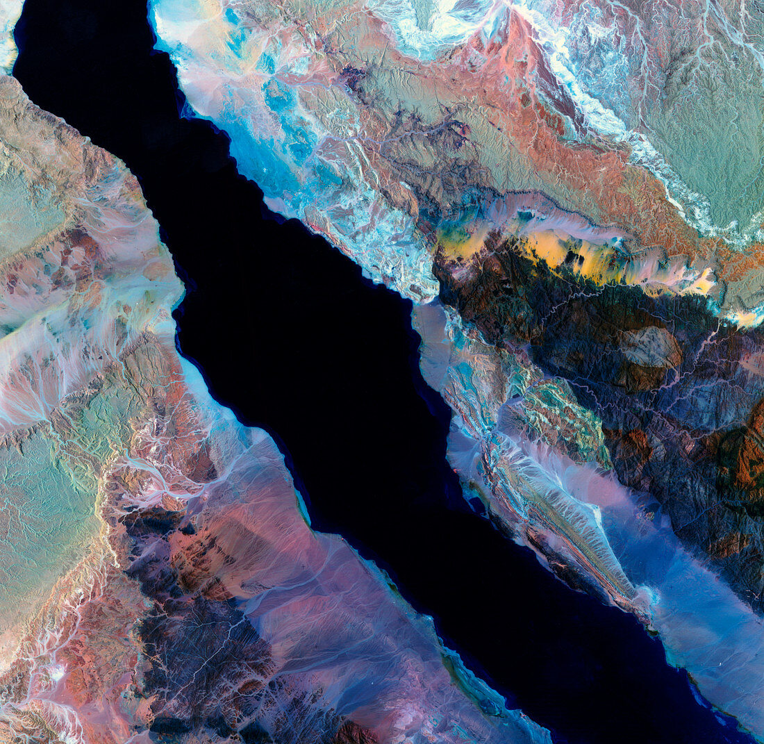
Gulf of Suez,Egypt
Bildnummer 11736068

| Gulf of Suez,Egypt,satellite image. North is at top. Water is black. The land geology is made more striking by a decorrelation processing of the data that has accentuated the colours. These show the range of rocks and minerals in this desert region. The Sinai Peninsula is at right,with the Egyptian mainland at left. Nearly the entire Gulf of Suez is seen. The Gulf of Suez is a shallow rift that forms one of the arms of the Red Sea. This 180- kilometre-wide image was taken on 9 June 1984,in visible & infrared wavelengths,with the Thematic Mapper (TM) sensor on a NASA Landsat satellite | |
| Lizenzart: | Lizenzpflichtig |
| Credit: | Science Photo Library / MDA Information Systems |
| Bildgröße: | 4450 px × 4333 px |
| Modell-Rechte: | nicht erforderlich |
| Eigentums-Rechte: | nicht erforderlich |
| Restrictions: | - |
Preise für dieses Bild ab 15 €
Universitäten & Organisationen
(Informationsmaterial Digital, Informationsmaterial Print, Lehrmaterial Digital etc.)
ab 15 €
Redaktionell
(Bücher, Bücher: Sach- und Fachliteratur, Digitale Medien (redaktionell) etc.)
ab 30 €
Werbung
(Anzeigen, Aussenwerbung, Digitale Medien, Fernsehwerbung, Karten, Werbemittel, Zeitschriften etc.)
ab 55 €
Handelsprodukte
(bedruckte Textilie, Kalender, Postkarte, Grußkarte, Verpackung etc.)
ab 75 €
Pauschalpreise
Rechtepakete für die unbeschränkte Bildnutzung in Print oder Online
ab 495 €
Keywords
- Afrika,
- Afrikanisch,
- Ägypten,
- Ägyptisch,
- Bodennutzung,
- Erdkunde,
- Erweiterung,
- farbig,
- Felsen,
- geografisch,
- Geographie,
- Geologie,
- geologisch,
- infrarot,
- ir,
- Juni,
- Land,
- Länder,
- Mineralien,
- Nation,
- Nationen,
- optisch,
- Rotes Meer,
- Satellit,
- Sichtbar,
- Tm,
- trocken,
- Umwelt,
- verbessert,
- Wasser,
- Weltall,
- Wissenschaften,
- Wüste
