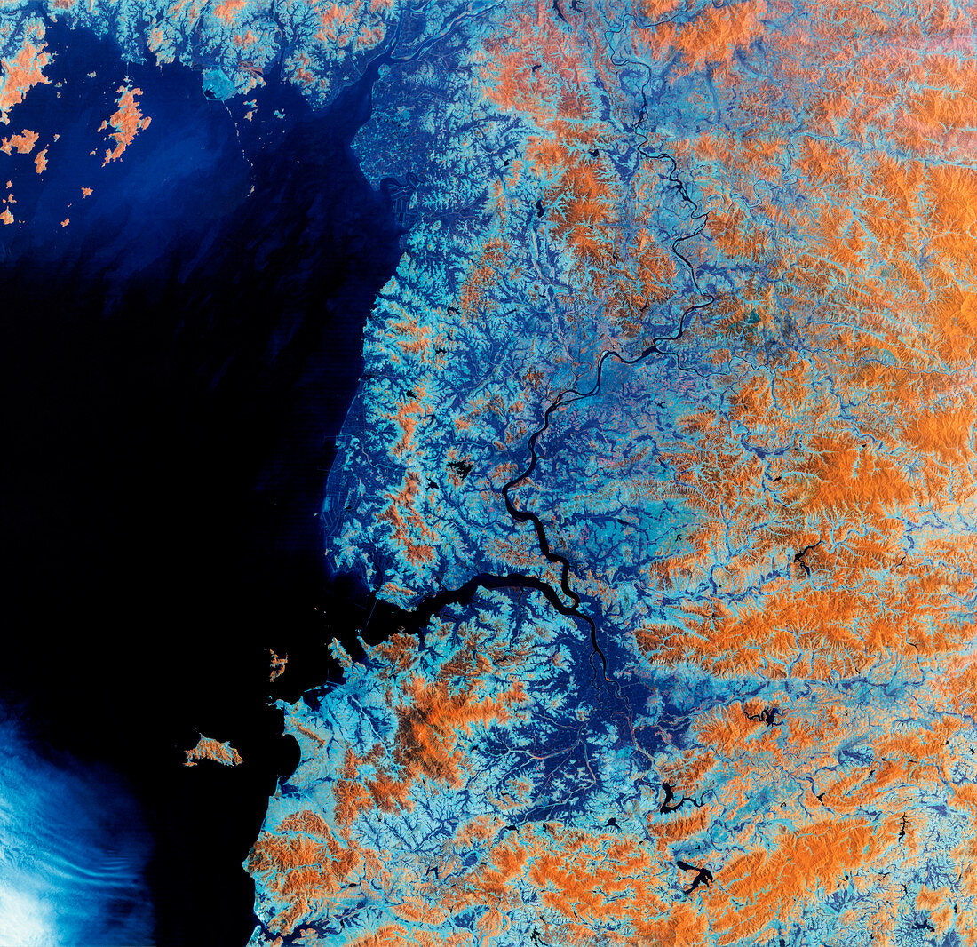
Western coastline of North Korea
Bildnummer 11736067

| Western coast of North Korea,satellite image. North is at top. The relatively infertile soils of high ground are orange,while the fertile soils of the river valley plains are dark blue. Water shows as black. North Korea is a mountainous country and its lowlands are largely confined to the western coast. Alluvial plains (lower centre) surround the Chaeryong River,which meets the Taedong River (flowing north-south) at the large gulf of Namp'o Bay. This 180-kilometre-wide image was taken on 1 June 1992,in visible and infrared wavelengths,with the Thematic Mapper (TM) sensor on a NASA Landsat satellite | |
| Lizenzart: | Lizenzpflichtig |
| Credit: | Science Photo Library / MDA Information Systems |
| Bildgröße: | 4245 px × 4115 px |
| Modell-Rechte: | nicht erforderlich |
| Eigentums-Rechte: | nicht erforderlich |
| Restrictions: | - |
Preise für dieses Bild ab 15 €
Universitäten & Organisationen
(Informationsmaterial Digital, Informationsmaterial Print, Lehrmaterial Digital etc.)
ab 15 €
Redaktionell
(Bücher, Bücher: Sach- und Fachliteratur, Digitale Medien (redaktionell) etc.)
ab 30 €
Werbung
(Anzeigen, Aussenwerbung, Digitale Medien, Fernsehwerbung, Karten, Werbemittel, Zeitschriften etc.)
ab 55 €
Handelsprodukte
(bedruckte Textilie, Kalender, Postkarte, Grußkarte, Verpackung etc.)
ab 75 €
Pauschalpreise
Rechtepakete für die unbeschränkte Bildnutzung in Print oder Online
ab 495 €
Keywords
- Asiatisch,
- Asien,
- Berg,
- Berge,
- Boden,
- Bodennutzung,
- einfach,
- Erdkunde,
- farbig,
- Fluss,
- Flüsse,
- Fruchtbar,
- geografisch,
- Geographie,
- infrarot,
- ir,
- Juni,
- Koreanisch,
- Küste,
- Küsten-,
- Küstenlinie,
- Land,
- Länder,
- montan,
- Nation,
- Nationen,
- optisch,
- Pflanzen,
- Satellit,
- Sichtbar,
- Tal,
- Täler,
- Tm,
- Umwelt,
- Vegetation,
- Wasser,
- Weltall,
- Wissenschaften
