Geostationary orbit diagram
Bildnummer 11620915
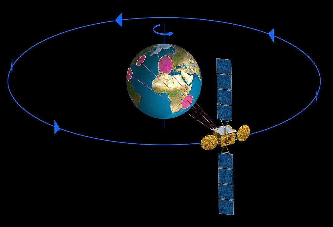
| Geostationary orbit diagram. This orbit (blue circle) is used for telecommunication and weather satellites. The satellites orbit at an altitude of 35,786 kilometres above the equator,completing one orbit in the same amount of time that it takes the Earth to turn on its axis (rod and arrow). This means that the satellite remains stationary over a fixed point on the equator,allowing it to continuously observe,or receive and transmit from,a fixed region of the Earth,some directly below,others further away (four example areas highlighted in pink). This orbit is also called Geostationary Earth Orbit (GEO). Solar panels (blue) provide power | |
| Lizenzart: | Lizenzpflichtig |
| Credit: | Science Photo Library / Ducros, David |
| Bildgröße: | 5086 px × 3461 px |
| Modell-Rechte: | nicht erforderlich |
| Eigentums-Rechte: | nicht erforderlich |
| Restrictions: | - |
Preise für dieses Bild ab 15 €
Universitäten & Organisationen
(Informationsmaterial Digital, Informationsmaterial Print, Lehrmaterial Digital etc.)
ab 15 €
Redaktionell
(Bücher, Bücher: Sach- und Fachliteratur, Digitale Medien (redaktionell) etc.)
ab 30 €
Werbung
(Anzeigen, Aussenwerbung, Digitale Medien, Fernsehwerbung, Karten, Werbemittel, Zeitschriften etc.)
ab 55 €
Handelsprodukte
(bedruckte Textilie, Kalender, Postkarte, Grußkarte, Verpackung etc.)
ab 75 €
Pauschalpreise
Rechtepakete für die unbeschränkte Bildnutzung in Print oder Online
ab 495 €
Keywords
- 1900er Jahre,
- 20. Jahrhundert,
- 21. Jahrhundert,
- Afrika,
- Afrikanisch,
- Amerikanisch,
- Beobachten,
- Diagramm,
- Erde,
- Europa,
- europäisch,
- Illustration,
- Kommunikation,
- kommunizierend,
- Kunstwerk,
- Meteorologie,
- meteorologisch,
- Orbit,
- Orbital,
- Physik,
- physisch,
- Planet,
- planetarisch,
- Raum,
- Satellit,
- Sonnensystem,
- Technologie,
- technologisch,
- Telekommunikation,
- umkreisend,
- uns,
- Weltraumflug,
- Wetter