Arctic ice minimum extent, 2020
Bildnummer 13295982
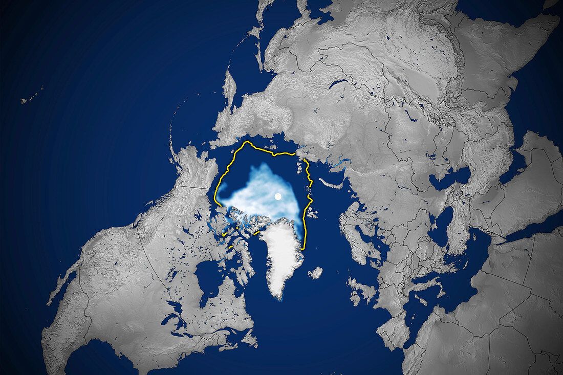
| Satellite image showing the Arctic polar ice cap at its annual minimum extent on 15th September 2020 and the 1981-2010 median extent (yellow line). The Arctic sea ice (white, centre) reaches a minimum in September, at the end of the Arctic summer. This minimal ice area is called the perennial ice cover. The perennial ice has been steadily decreasing since satellites began observing it in 1979, at a rate of about 10 percent per decade. The sea ice here covers 3.74 million square kilometres, the second lowest minimum since satellite monitoring began. This decrease is attributed to global warming. Data from microwave sensors on Defense Meteorological Satellite Program (DMSP) satellites. | |
| Lizenzart: | Lizenzpflichtig |
| Credit: | Science Photo Library / NSIDC / NASA |
| Bildgröße: | 3610 px × 2406 px |
| Modell-Rechte: | nicht erforderlich |
| Eigentums-Rechte: | nicht erforderlich |
| Restrictions: | - |
Preise für dieses Bild ab 15 €
Universitäten & Organisationen
(Informationsmaterial Digital, Informationsmaterial Print, Lehrmaterial Digital etc.)
ab 15 €
Redaktionell
(Bücher, Bücher: Sach- und Fachliteratur, Digitale Medien (redaktionell) etc.)
ab 30 €
Werbung
(Anzeigen, Aussenwerbung, Digitale Medien, Fernsehwerbung, Karten, Werbemittel, Zeitschriften etc.)
ab 55 €
Handelsprodukte
(bedruckte Textilie, Kalender, Postkarte, Grußkarte, Verpackung etc.)
ab 75 €
Pauschalpreise
Rechtepakete für die unbeschränkte Bildnutzung in Print oder Online
ab 495 €
Keywords
- 21. Jahrhundert,
- alljährlich,
- Arktis,
- Arktischer Ozean,
- DMSP,
- Erdbeobachtung,
- Erde,
- geografisch,
- Geographie,
- Globale Erwärmung,
- Klimatologie,
- klimatologisch,
- Klimawandel,
- Meer,
- Meereis,
- Niemand,
- Nördlicher Polarkreis,
- Ozean,
- Passage,
- Programm,
- Region,
- Rückzug,
- Satellit,
- Satellitenbild,
- Schmelzen,
- Umwelt,
- Verschwinden,
- Verteidigung,
- Weltall